March 14, 2016. On a stormy day, my son Murat and I set off from Istanbul towards Adana. Our aim was to take aerial shots for my photography exhibition to be organized within the framework of the Orange Blossom Carnival in Adana in April. A few months earlier, when I was asked to do an event at the carnival, I decided to organize an exhibition of aerial photographs of Adana and its surroundings.
I started paramotoring in 2003 in order to shoot aerial photographs as well as the pleasure it would bring. In the following years, I photographed from the air in many parts of Turkey for both commercial and personal purposes. My first aerial photography exhibition titled "High Angle" was held at PG Art Gallery in Istanbul in 2008 and has been followed by other aerial photo exhibitions since. I was very excited about the idea of organizing such an exhibition for Adana where I was born and raised.
We determined the shooting locations after a few months of research with my friend Bülent Tüzün from Tarsus American College. There were many unknowns in this project in terms of weather, take-off and landing areas and risks due to the geography. We decided to evaluate these on the spot. When my son Murat, himself a paramotor pilot, decided to join me, there was no doubt in my mind that this project would succeed.
After a one-day visit to Adana for research on exhibition space and display, we set to work. The weather was on our side except for a couple of days during ten days of shooting. Watching the natural and historical texture of Adana from the air was also a first for me. We completed the project successfully without any serious setbacks and opened the exhibition in April. The praise I received at the exhibition, which attracted more attention than I expected, showed once again that we have done the right thing. I felt that I have brought a permanent project to Adana and created a work that I was proud of...
Behind-the-scenes video: "Aerial Adana" series behind the scenes
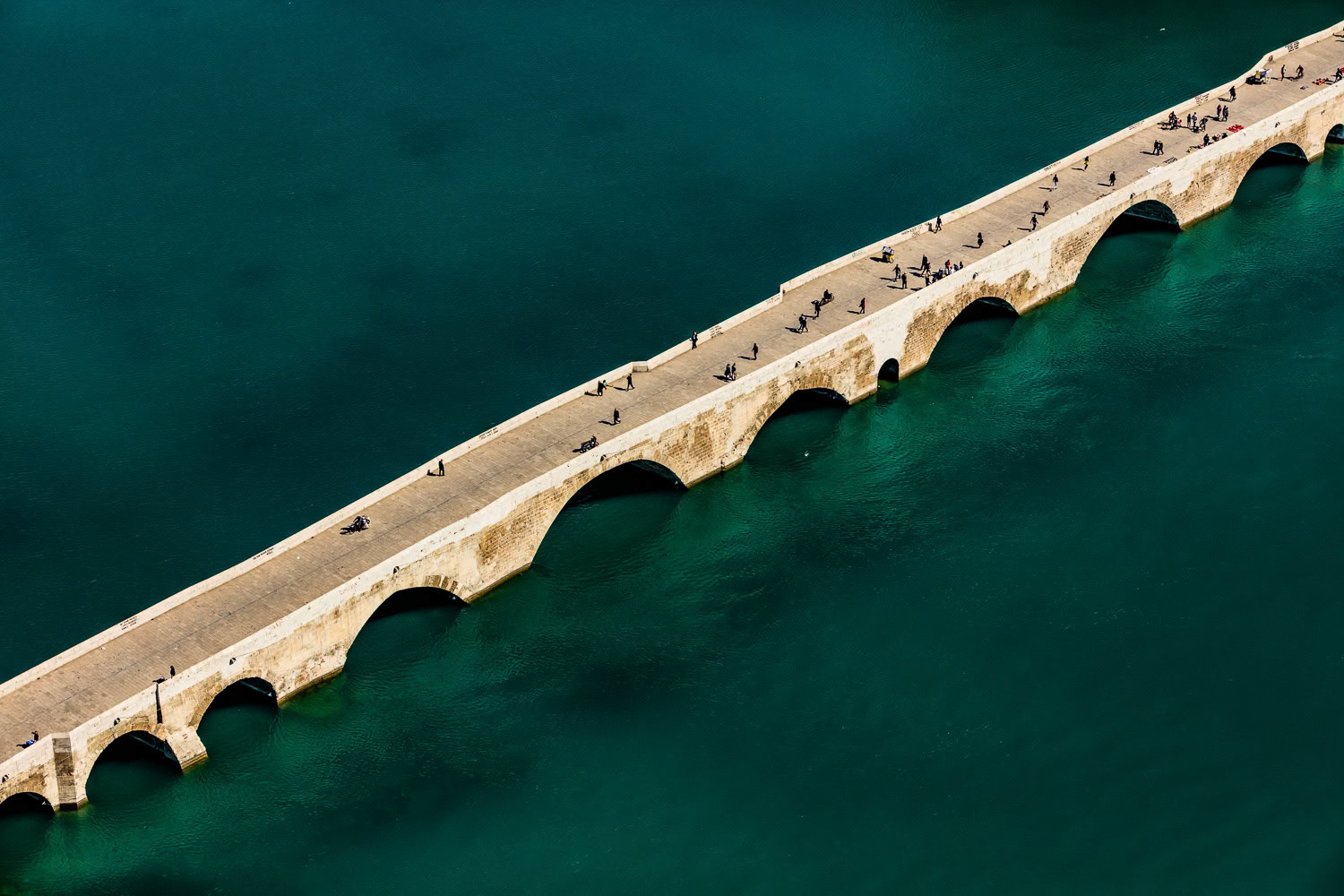
"Stone Bridge" - Stone Bridge (Taşköprü) is a Roman monument that connects the east and west sides of Adana city center on the Seyhan River. During my childhood years, we passed through Taşköprü almost every day in the summer on our way to the sea in Karataş. The bridge, now closed to vehicle traffic, is the most important symbol of Adana for me. I had to shoot it in a different and impressive style. I isolated the bridge inside the blue green shades of the Seyhan River. The people on it added extra color and richness.
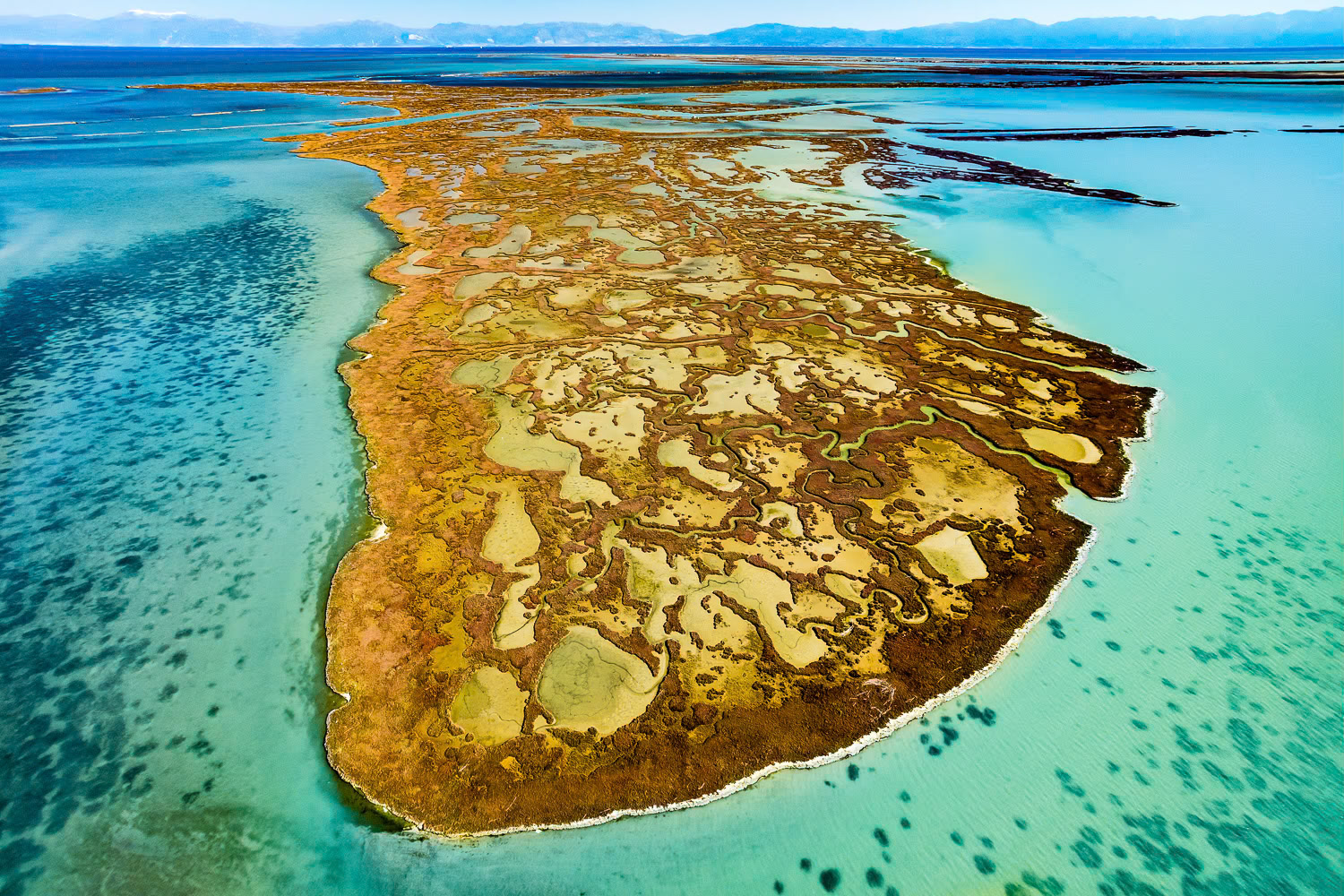
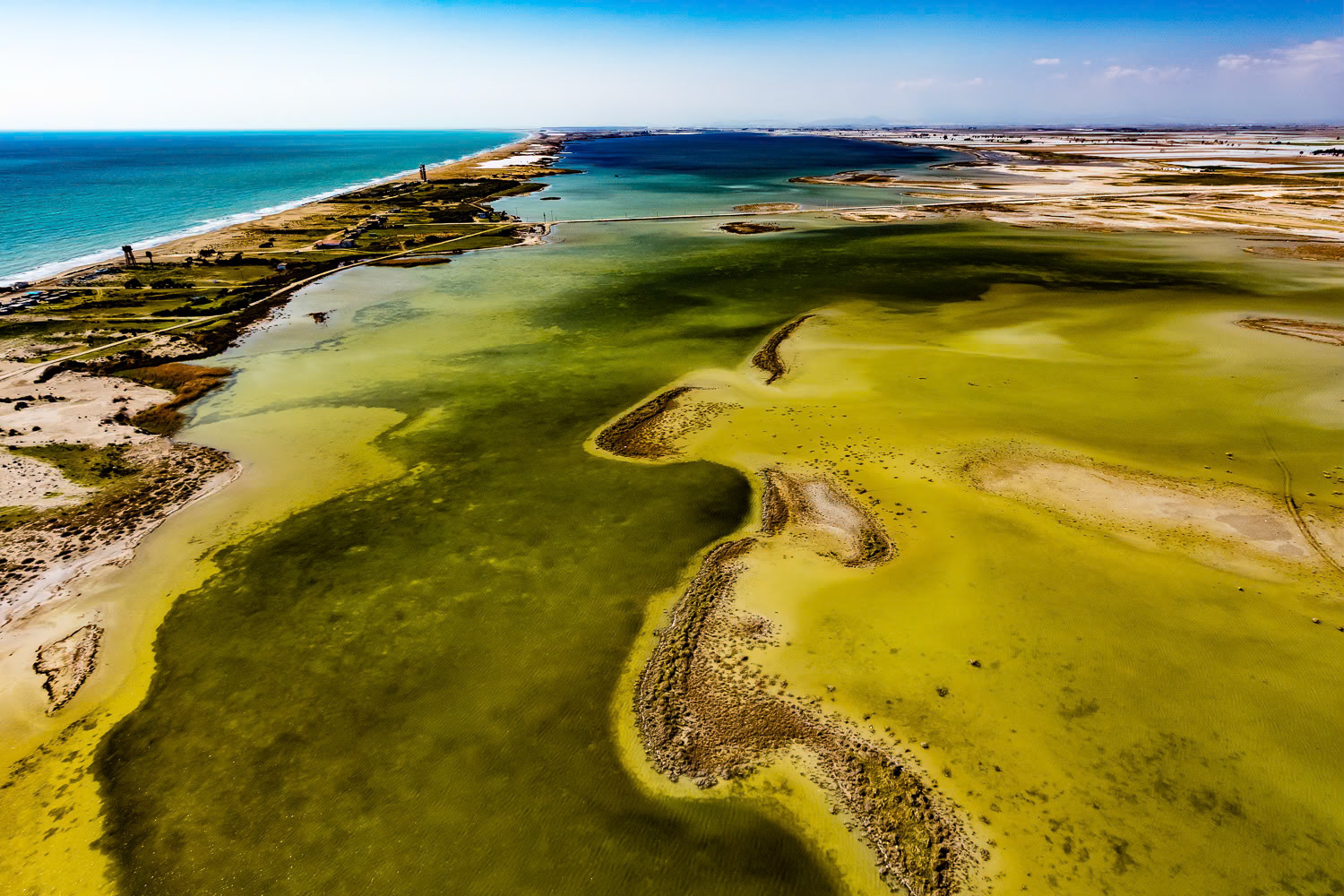
"Yumurtalik 2" - There is a giant wetland system between the mouth of the Ceyhan River and the Yumurtalik Gulf, consisting of lagoons, salt marshes, mud flats, reeds, wet meadows, sand dunes and a pine forest. The main wetlands are the Yumurtalik (or Çamlik) lagoon and the fisheries inside of these. The salt marshes in Yumurtalık, which take on different colors in different seasons, looked like a thin line when viewed from land. When I went up in the air I met with a scene evocative of tropical paradise islands.
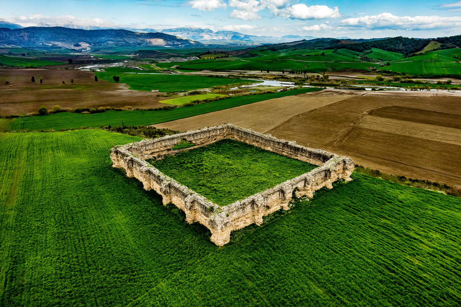
"Kesiri Inn" - During the Crusades, many accommodations and castles were built in this location, which served as the most important gateway from Anatolia to the east. When I came within shooting range, I saw that the dimensions of the inn, the design and the contrast it made with the colors of the cultivated areas were very impressive. It started to rain and I made a pass at the angle that I wanted, shot my frames and decided to land at the first suitable spot. There was only a narrow dirt road between the cultivated fields where I could land safely without getting my wing any wetter. I looked for a sign to determine the wind direction but I could not find any. At that moment, I saw a farmer in yellow boots walking on the road. I flew over, idled the engine and called out, "Where is the wind coming from?" The farmer turned into the wind, moved his two arms up and down, and showed me the direction of the wind in a way that only those in the know can do. I made a short circle and landed safely. The wit of the people of this land surprised me once again.
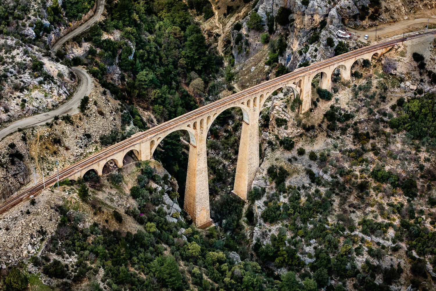
"Varda Bridge" - Varda Bridge is a 172 meter long stone masonry-type bridge, built with great difficulty at the beginning of the 20th century by German engineers and still in use today. We knew that this aesthetic bridge was located in a risky terrain for flying. After a long and winding journey, we arrived at the bridge in a valley of the Taurus Mountains. We searched for a flat and open area for my takeoff. Fortunately, we found a suitable field not too far from the bridge. I photographed the bridge in a turbulent air with downdrafts that tossed me around due to the shape of the land. Although it was not a comfortable flight, it was a great pleasure to photograph this historical structure.
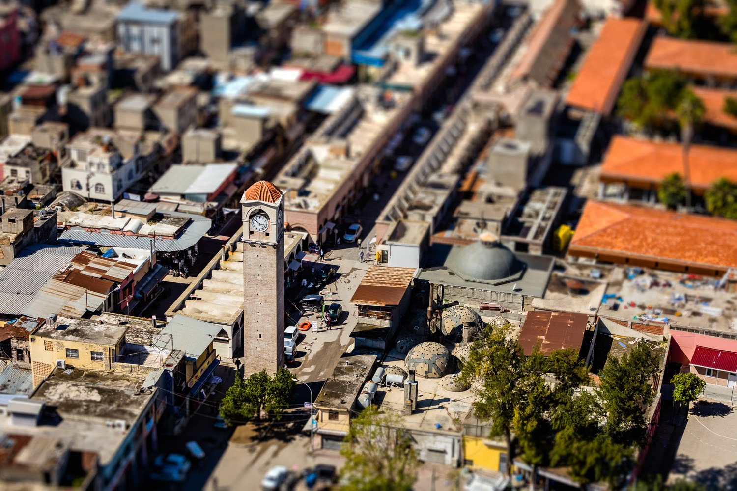
"Big Clock" - The Great Clock Tower was seen as the symbol of modernization in the history of Adana. It is Turkey's tallest clock tower with its 32 meter height. I had to find the most suitable angle to capture this other important symbol of Adana with its surroundings. After flying near it for a while, I took my shot where I felt the tower best stood out.
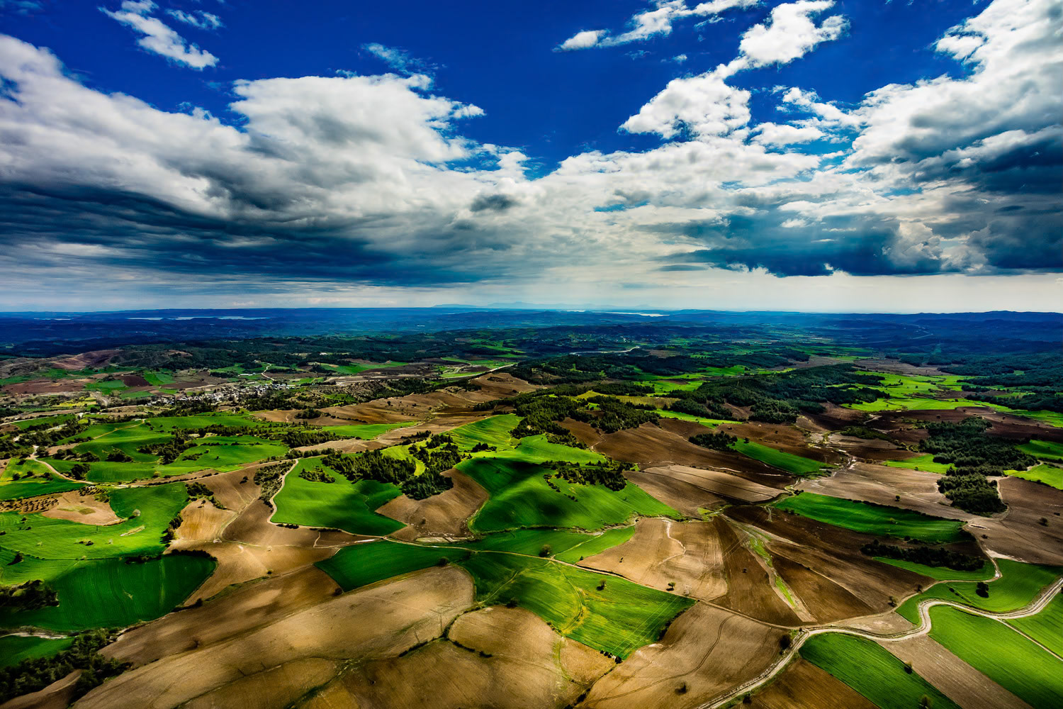
"Karaisali" - Karaisali is a town located 51 km north-northwest from the Adana city center and has been home to various civilizations since it was founded by the Romans. It always attracts tourists with its historical and natural parks. The stunning aesthetic created by the colors of nature in spring preparation, vast Cukurova plain's farmlands and the seasonal clouds that I witnessed during this shoot have made me feel like flying inside a dramatic oil painting.
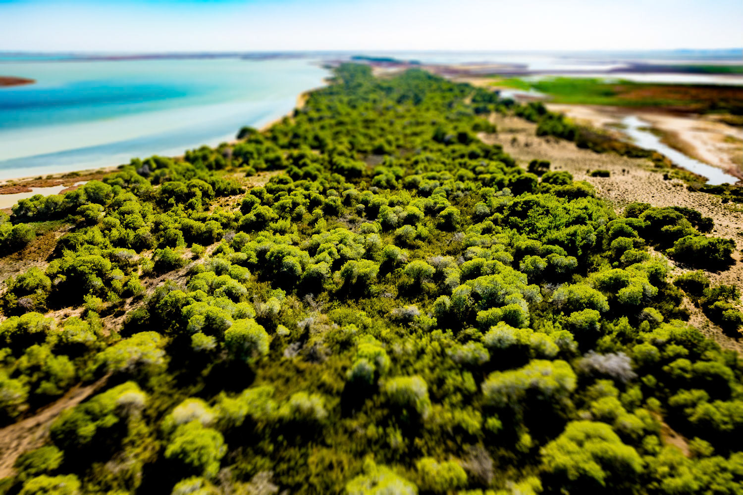
"Pine Grove" - On a peninsula in Yumurtalık-Çamlık lagoon, is one of Turkey's rare Aleppo pine (Pinus halepensis) forests, covering an area of 59 hectares. The Pine Grove region in Yumurtalık looked like a green oasis tucked between the brown of the fields and the blue of the sea. I am always excited about the surprising aerial views that we do not notice on the surface. Pine Grove was one of the best examples of this. The presence of such a protected nature area in Adana made me extra happy.
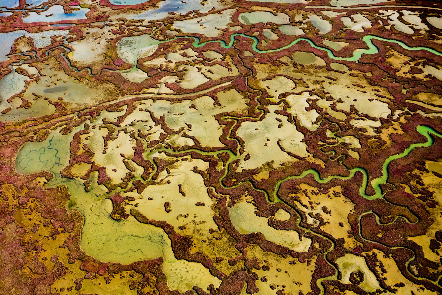
"Yumurtalik 3" - There is a giant wetland system between the mouth of the Ceyhan River and the Yumurtalik Gulf, consisting of lagoons, salt marshes, mud flats, reeds, wet meadows, sand dunes and a pine forest. The main wetlands are the Yumurtalik (or Çamlik) lagoon and the fisheries inside of these. - The detail I saw in the colorful salt marshes on the sea in the Yumurtalık lagoon resembled a jigsaw puzzle.
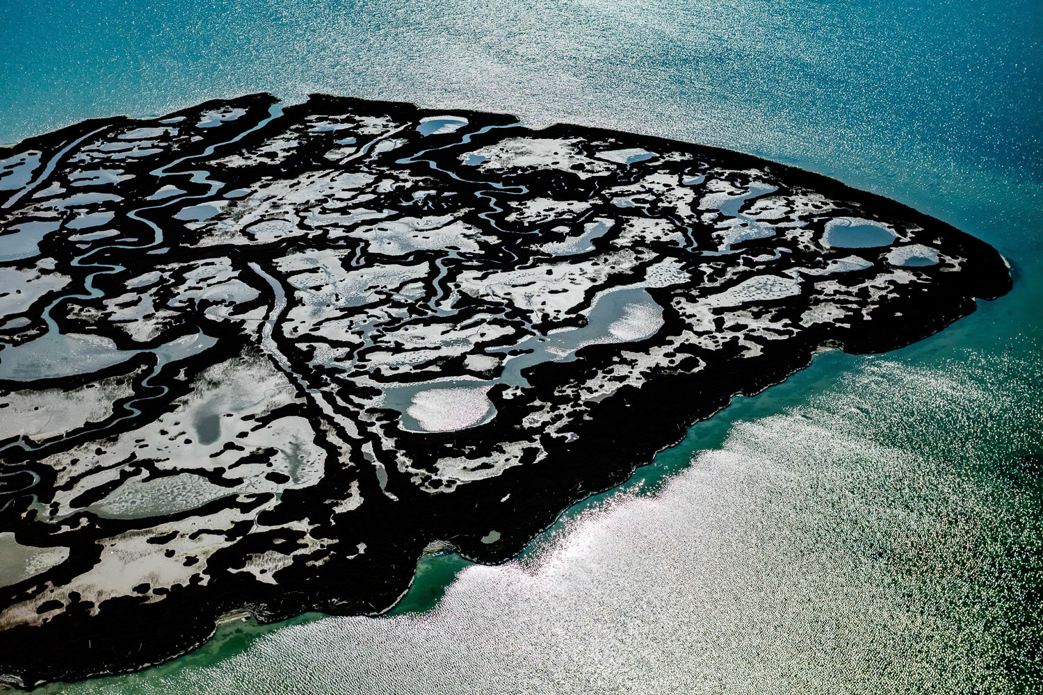
"Lonely Planet" - There is a giant wetland system between the mouth of the Ceyhan River and the Yumurtalık Gulf, consisting of lagoons, salt marshes, mud flats, reeds, wet meadows, sand dunes and a pine forest. I decided to shoot the salt marshes in Yumurtalık backlit. It took a long and bumpy flight against the wind to finally get into the right position and capture the high-contrast graphic shot I wanted. The image also took place in my later “Untamed’ series.
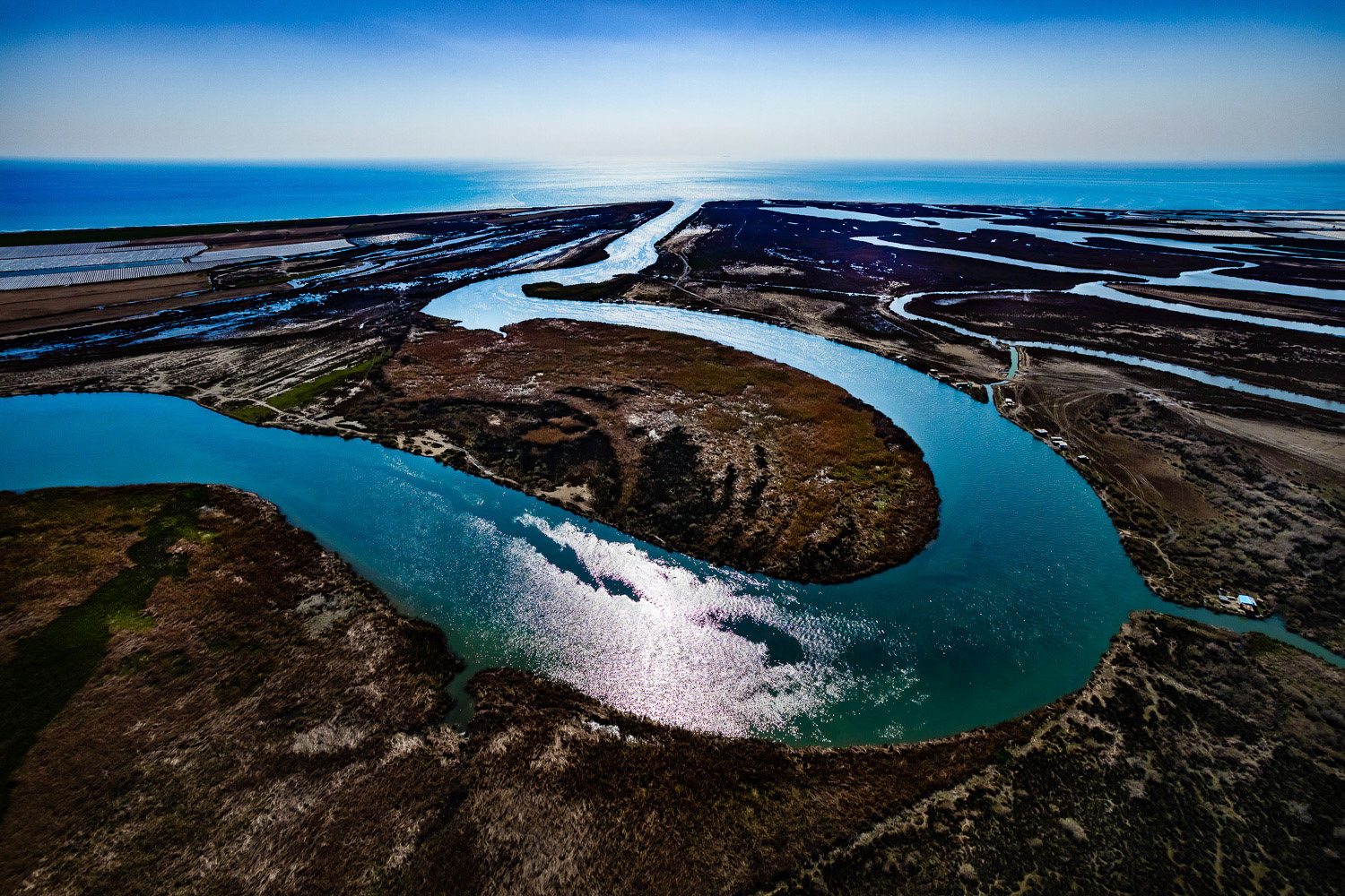
"Seyhan" - Seyhan River is the most important of Turkey's rivers flowing into the Mediterranean. Its length is 850 kilometers. I wanted to capture the exquisite curves of the Seyhan River. I figured that I could do this in the delta where the river flows into the Mediterranean and it would be easier to reach the region from the air. So I decided to take off from Akyatan Lake, 25 kilometers east. I reached the area after a long flight. When I flew behind the big curve of the river to capture the photograph that I wanted, I was surprised by the very rough turbulence. The situation was a little dangerous but I was determined. After getting the result that I wanted, I returned to my starting point, again after a long flight.
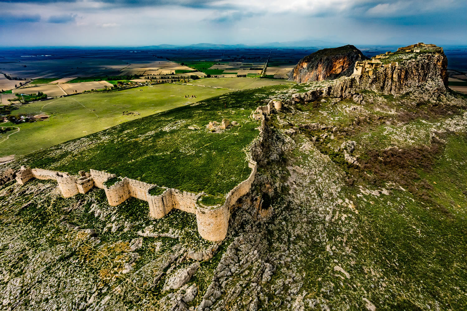
"Anavarza" - The ancient city of Anavarza (Anazarbus/Caesarea ad Anabarsum) is located 28 kilometers south of the Kozan town of Adana. Among the important remnants of Anavarza is the medieval castle on the hill rising like an island in the middle of the plain. The magnificent castle and city, reminiscent of a film decor, continues to live in today's village houses with tired stones bearing traces of the past. My paramotor broke down after finding a suitable place for takeoff. Fortunately, I had my second motor and I was able to shoot this wonderful castle.
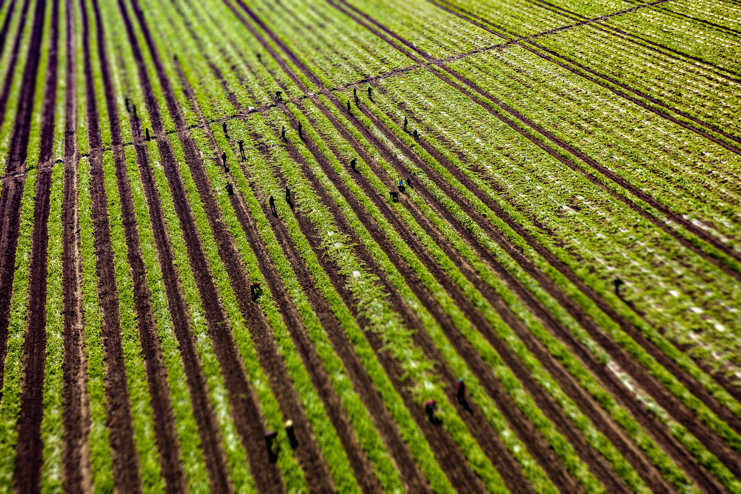
"Field" - Çukurova meets 85 percent of Turkey's citrus production and exports. I learned that these fields, which are located immediately next to the Mediterranean Sea, are very valuable due to their sandy composition. Since large cultivated areas come to my mind when Çukurova is mentioned, I couldn’t do without shooting a field detail. Compositional elements that I teach in my courses, perspective, lines, diagonals, texture, pattern, surface, backlight and contrast are all in this minimalist photograph.
"Tuzla" - Tuzla Fishery, located in the delta where Seyhan River meets with the Mediterranean in the south of Adana, is spread over an area of 800 hectares. We went to Tuzla Lake hoping to see the flamingos migrating in the spring months. Unfortunately, we learned that they did not move down from north to south that year due to global warming. During the flight, that wonderful natural and virgin structure of Tuzla was laid under my feet. I heartily wish that this coastal area between Ceyhan and Seyhan rivers will remain as it is.
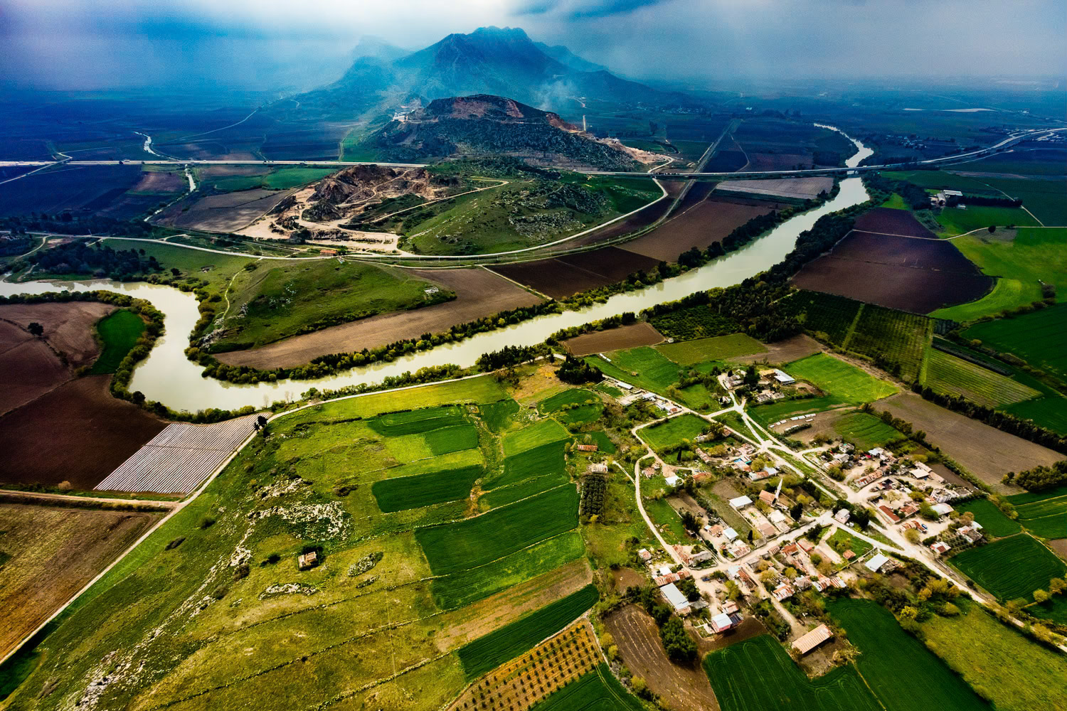
"Küçükburhaniye" - Ceyhan River and Küçükburhaniye Village near Yilankale (Snake Castle). The foggy blue hills in the background, fields of different shades of green and brown, the village of Küçükburhaniye, the meandering Ceyhan river and the modern highway in the form of a thin line reminded me of Far Eastern style landscapes.

"Snake Castle" - Yilankale (Snake Castle) is located 10 km west of the town of Ceyhan. During the Crusades in the 12th Century, it was built on a dominant hill near the Ceyhan river. It's one of the most important of the nearly 50 castles in Adana. When I arrived to photograph it, I found a very narrow path suitable for takeoff between cultivated areas. After the takeoff, this stunning white castle built on sheer rocks and twisting like a serpent, seemed like an unreal figure out of fantasty films.
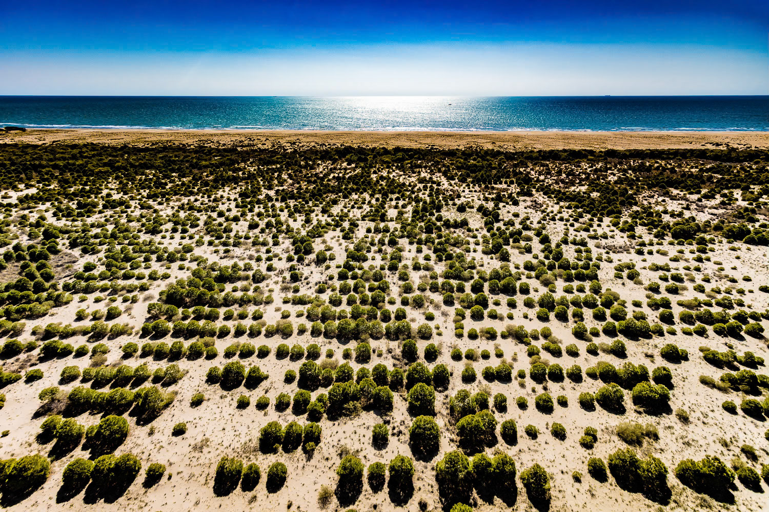
"Akyatan" - On the shore of the Akyatan Lake, the orderly area with trees resembling rows of musical notes turns into an intricate tangle near the sea, separated from the blue Mediterranean which reflects the harsh sun of Çukurova, by a thin sandy beach.
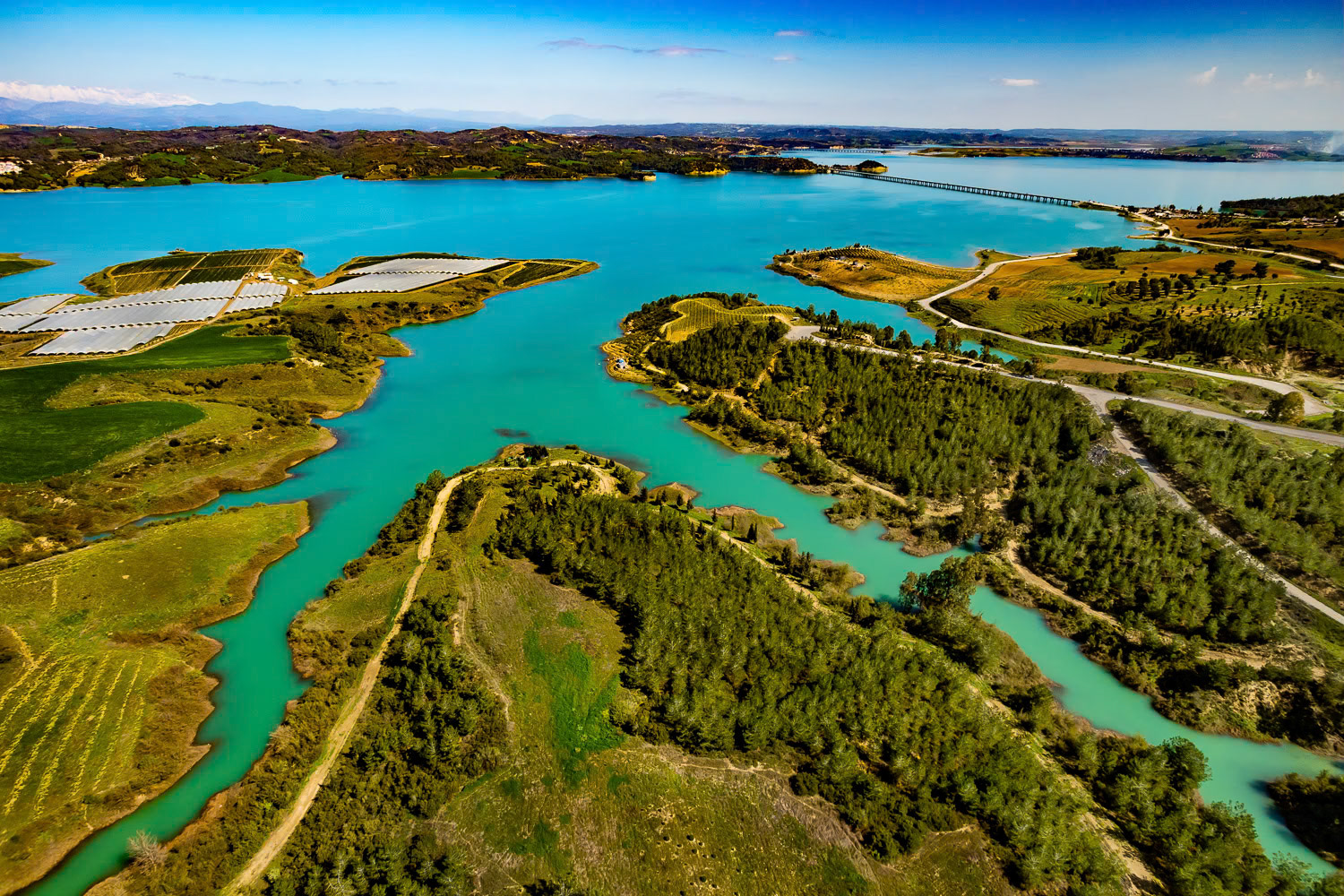
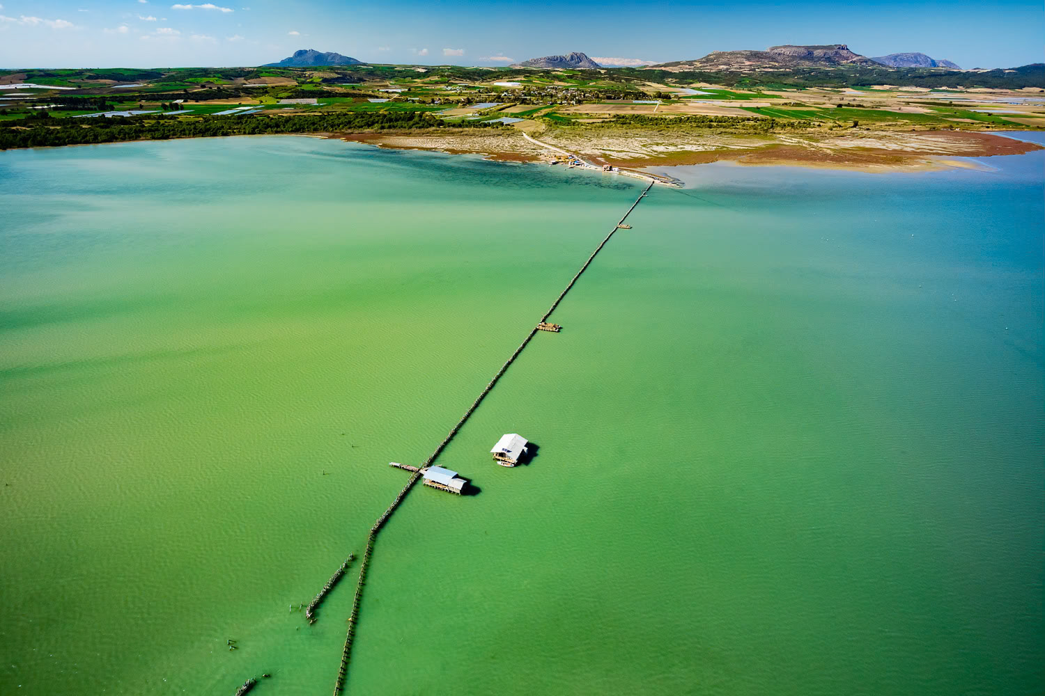
"Dam Lake" - Built in 1953, Adana Seyhan Dam is still used for hydroelectricity generation and modern irrigation of the entire Çukurova region. I wanted to shoot the Dam Lake, an artificial lake, with its fjords. Although we found the takeoff point I had discovered 12 years ago to fly in the same region, there was a very narrow area left because the water level rose. Since we couldn't find a more suitable area considering the wind direction, I took the risk of the wing falling into the water. Fortunately, I successfully took off, flew and landed.
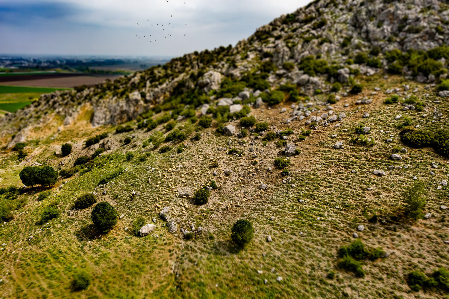
"Herd" - At the foot of the hill on which Yılankale is built, I came across a large flock of sheep, a shepherd's dog, a shepherd, his wife on a donkey and a flock of storks that had just migrated to the country from Africa. After landing under the curious gaze of the four young people we met at the take-off area, we did not forget to take a selfie with the little girl who came running breathlessly from her village with her mobile phone in her hand.
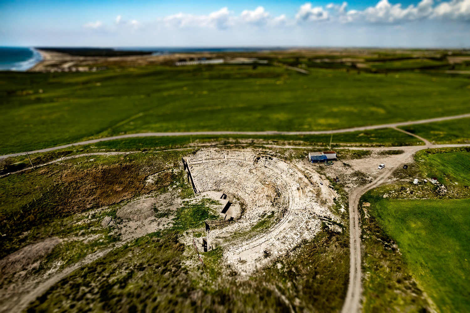
"Magarsus" - The ancient city of Magarsus, located on the coast of Karatas district, 49 kilometers from Adana, was founded in the 7th century BC. This theater near Karataş, unearthed a few years ago, hints at the hidden treasures that lie beneath the soil of Çukurova. I was very happy and surprised to see it since we were not aware of its existence when I was a kid swimming at the beaches of Karataş.
"Yumurtalik Fishery" - There is fishing in the natural fishery in the Sarıgöl area where fish such as sea bass, mullet and bream enter for nesting in the season. It’s a resting stop for migratory birds such as ducks, geese and flamingos. This area, used for fishing, suddenly appeared before me like a painting. The color gradient that started in the water continued in different shades on land. Very calm flight conditions which normally occur by the sea were not so in the Çukurova area. Air turbulence created by thermals caused by the lay of the land made flying difficult.
Behind-the-scenes:
Join my mailing list and become an insider.